
10min 13s Novice
Why was this earthquake a surprise to the scientific community?
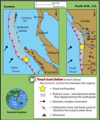
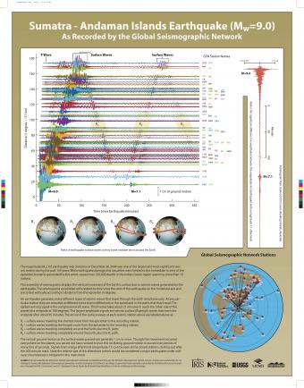
From 1900 through 2003, only five magnitude 7.7 or larger earthquakes were recorded by seismometers on Sunda Subduction Zone boundary. If we go back to 1797, three great magnitude 8 or larger megathrust earthquakes occurred on the Australia–Sunda plate boundary but none occurred on the India–Sunda plate boundary. Many considered subduction too slow or too oblique to produce a great earthquake on that plate boundary. They would be proven wrong.
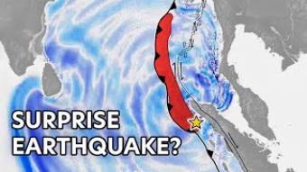
On December 26th, 2004, a magnitude 9.1 earthquake ruptured the Sunda subduction zone north of Sumatra. The resulting tsunami swept across the Indian Ocean basin in 11 hours. It took over 220,000 lives in 14 countries to become the worst tsunami disaster in human history. Why was this horrific natural disaster a surprise to the scientific community and nations of the region?
In this animation:
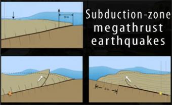
Subduction-zone megathrust earthquakes, the most powerful earthquakes in the world, can produce tsunamis through a variety of structures that are missed by simple models including: fault boundary rupture, deformation of overlying plate, splay faults and landslides. From a hazards viewpoint, it is critical to remember that tsunamis are multiple waves that often arrive on shore for many hours after the initial wave.
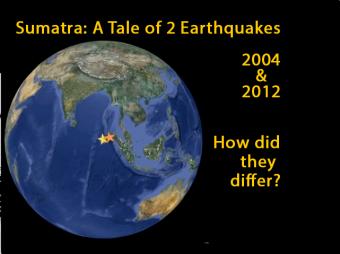
In 2004 a Magnitude 9.1 interplate subduction earthquake triggered a tsunami that killed over 230,000 people. Yet a nearby magnitude 8.7 intraplate earthquake in 2012, caused little damage and generated minimal ocean waves. This animation describes the different tectonic settings of the two plates, and how the Indo-Australian plate seems destined to become two distinct tectonic plates: the Indian and the Australian plates.
UPDATED (Jan, 2022) - New Ending On Convection
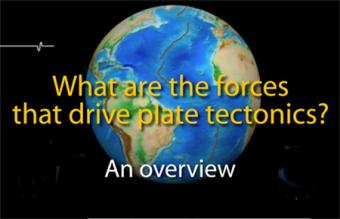
Lithospheric plates are part of a planetary scale thermal convection system. The energy source for plate tectonics is Earth’s internal heat while the forces moving the plates are the “ridge push” and “slab pull” gravity forces.
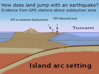
GPS records the movement of the leading edge of the overlying continental plate in a subduction zone. The plates are locked and the overlying plate is forced back. When friction is overcome and strain is released, the GPS receiver will snap back toward its original position.
TEASER: Intro to IRIS's "Geographic Region" series. Our "World Series" addresses regional tectonic forces and resulting recent and historic earthquakes around the world (ex. Japan, Alaska, Peru-Chile, Central America, Mexico, Pacific Northwest).
We encourage the reuse and dissemination of the material on this site as long as attribution is retained. To this end the material on this site, unless otherwise noted, is offered under Creative Commons Attribution (CC BY 4.0) license
