1h Novice
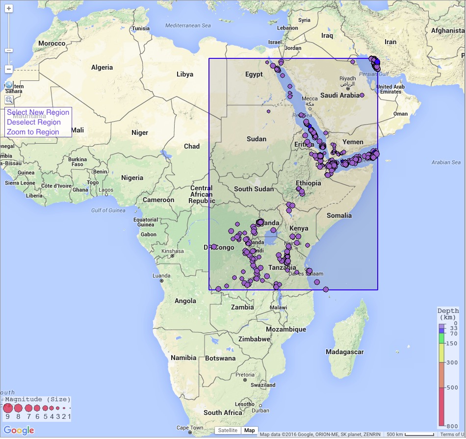
The Interactive Earthquake Browser shows how earthquakes define plate boundaries
In this activity students review their prior knowledge about various types of plate boundaries. Next students use the IRIS Earthquake Browser to investigate well-known examples of some of these boundaries. Students are asked to pay particular attention to the spatial distribution, rate of seismicity, and depth of quakes in each area. Students then point IEB to a new region and are asked to use the “templates” of seismic evidence they have previously constructed for the primary plate boundaries to argue for what is occurring within the mystery region.
Students will be able to:
Describe the basic properties of crustal rocks
Use the IRIS Earthquake Browser to
Apply knowledge to identify a developing plate boundary
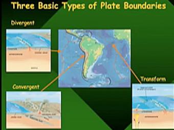
Video lecture covers three basic types of tectonic plate boundaries.
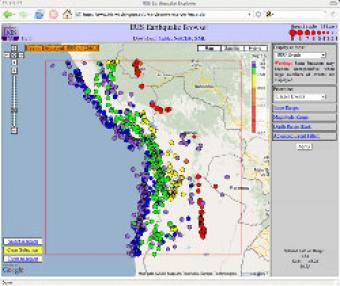
The IRIS Earthquake Browser (IEB) is an interactive tool for exploring millions of seismic event epicenters (normally earthquakes) on a map of the world. Selections of up to 5000 events can also be viewed in 3D and freely rotated with the 3D Viewer companion tool.
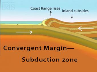
The subduction zone iswhere two tectonic (lithospheric) plates come together, one subducting (diving) beneath the other. The plates are locked together and periodically overcome the friction causing the leading edge of the overlying plate to surge back, lifting a wall of water producting a tsunami.
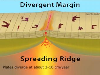
New oceanic crust is created at this boundary when basalt magma, formed in the mantle, rises into fractures in the crust and solidifies. Spreading ridges are high elevation because the young oceanic plate at the ridge crest is hot and less dense than the older, colder and more dense plate on the flanks of the ridge.
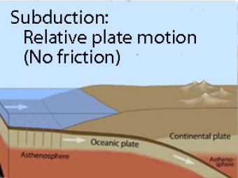
Oblique view of a highly generalized animation of a subduction zone where an oceanic plate is sliding beneath a continental plate with no friction just to show the relative motion between the plates..
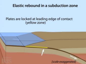
Oblique view of a highly generalized animation of a subduction zone where an oceanic plate is subducting beneath a continental plate. (See sketch below for parts.) This scenario can happen repeatedly on a 100-500 year cycle. The process which produces a mega-thrust earthquake would generate a tsunami, not depicted here.
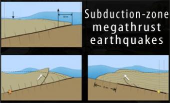
Subduction-zone megathrust earthquakes, the most powerful earthquakes in the world, can produce tsunamis through a variety of structures that are missed by simple models including: fault boundary rupture, deformation of overlying plate, splay faults and landslides. From a hazards viewpoint, it is critical to remember that tsunamis are multiple waves that often arrive on shore for many hours after the initial wave.
We encourage the reuse and dissemination of the material on this site as long as attribution is retained. To this end the material on this site, unless otherwise noted, is offered under Creative Commons Attribution (CC BY 4.0) license