Kinesthetic Modeling & Interpreting GPS Data Maps

Novice

  • Activity - Kinesthetic Modeling & Interpreting GPS Data Maps
  • Activity One pager - Kinesthetic Modeling & Interpreting GPS Data Maps
  • Appendix C - Printable Vector Components for Kinesthetic Activity
  • Appendix D - GPS Vector Maps
  • Appendix E - Human-scale modeling of ground deformation with Generic GPS Station Signs
  • Appendix F (PDF) GPS Station Information Placards for Kinesthetic Modeling
  • Appendix F (Powerpoint) GPS Station Information Placards for Kinesthetic Modeling
  • Appendix F Video Instructions for Making GPS Placards
  • Appendix G – 20-Min and 45-min Activity Handouts
  • Appendix H – 45-minute Activity Learner Outline
  • Appendix I – Instructor Answer Keys for 20-Min Activity Summary Handout and 45-min Learner Outline
  • Appendix J and K - Full GPS Vector Maps and Earthquake Shaking Potential Maps
Download All 190MB

Demonstrating Tectonic Motions in Earthquake Hazard Regions

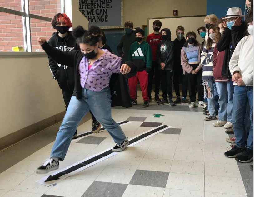
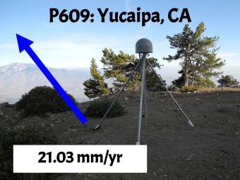
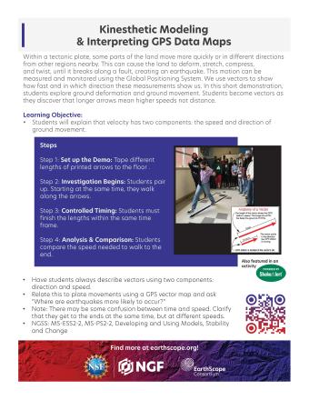
In this activity, learners explore ground deformation at and near plate boundaries using hand and body motions, data from GPS and maps. In the 5-minute activity, learners explore the concept of vectors by kinesthetically enacting ground movement using their body and hand movements. In the 20-minute activity, learners model GPS ground motion in different regions and connect deformation to earthquake hazards. In the 45-minute activity learners distinguish between different boundary types by measuring the vectors within tectonic plates and identify regions with higher earthquake hazards, comparing their findings to earthquake shaking potential maps.

Objectives:

Learners will be able to:

  • Explain that velocity has two components, the speed and direction of ground movement.
  • Illustrate or describe two types of tectonic plate boundary motion using velocity vectors.
  • Identify regions more likely to have higher earthquake hazards using relevant GPS evidence.
This video provides instructions to create GPS Station Information Placards for specific GPS stations that are used for students to model the motion of the ground and the deformation of the land between the GPS stations.
Demo Novice

We encourage the reuse and dissemination of the material on this site as long as attribution is retained. To this end the material on this site, unless otherwise noted, is offered under Creative Commons Attribution (CC BY 4.0) license