5min Novice
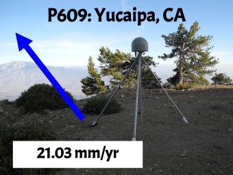
This video provides instructions to create GPS Station Information Placards for specific GPS stations that are used for learners to model the motion of the ground and the deformation of the land between the GPS stations. The GPS Station Information Placards provide a photograph of the specific GPS station, a vector to indicate the speed and direction that the GPS station and ground is moving, and the velocity in millimeters per year. The placards are taped to the floor so that students can model the motion of the ground and the deformation of the land between the GPS stations.

We encourage the reuse and dissemination of the material on this site as long as attribution is retained. To this end the material on this site, unless otherwise noted, is offered under Creative Commons Attribution (CC BY 4.0) license