
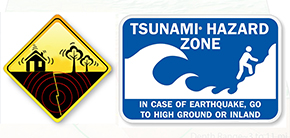
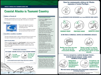
This factsheet and related infographics provide essential safety information on staying safe in the event of a tsunami for residents and visitors in Alaskan fjord communities and coastal communities exposed to the Pacific Ocean. The factsheet is available in English, Canadian French, and Spanish, and the infographics are available in nine languages.
Go to Resource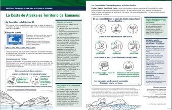
Sin importar si la costa de Alaska es su hogar, su lugar de trabajo, o un destino de viaje, es importante saber cómo mantenerse a salvo en caso de un tsunami. La acción a tomar que le de mayor protección será determinada por su ubicación y el (los) tipo(s) de evento(s) que pueden desencadenar un tsunami en ese lugar. Hay más posibilidades de un tsunami local en las comunidades con fiordos (tales como Seward, Whittier, Valdez, Homer, y otras.) Allí, los deslices causados por un terremoto pueden alterar las aguas de la costa y causar un tsunami.
Go to Resource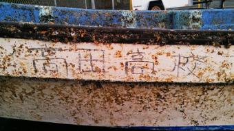
On April 7, 2013, a little over two years after a magnitude 9.0 earthquake triggered a massive tsunami off the coast of northeastern Japan, a lone boat washed up on the shores of Crescent City, California. The boat belonged to a high school in Rikuzentakata. This is the true story of a small boat that, through the efforts of a hardworking group of Crescent City students, forged friendships and brought hope to communities on both sides of the Pacific.
Go to Resource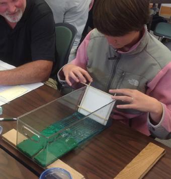
This activity investigates factors that affect how tsunami waves interact with submarine and shoreline topography. In a 5-minute computer simulation, learners discover how coastal topography dramatically affects how far a tsunami wave can travel. The 15-minute hands-on activity allows learners to explore several topographic features using a container to model tsunami waves. The 45-minute activity allows learners to compare and measure how two related landforms affect how far a tsunami wave travels inland, discovering the importance of tsunami wave inundation for community preparedness.
Go to Resource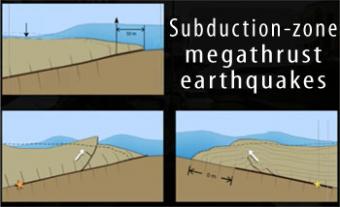
Subduction-zone megathrust earthquakes, the most powerful earthquakes in the world, can produce tsunamis through a variety of structures that are missed by simple models including: fault boundary rupture, deformation of overlying plate, splay faults and landslides. From a hazards viewpoint, it is critical to remember that tsunamis are multiple waves that often arrive on shore for many hours after the initial wave.
Go to Resource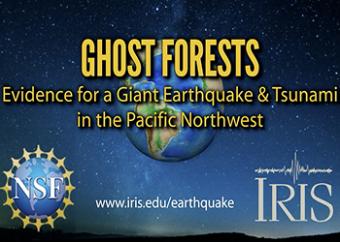
Ghost forests are part of the evidence that a Great earthquake and devastating tsunami occurred last on January 26th, 1700 in the Pacific Northwest. How do we know this?
Go to Resource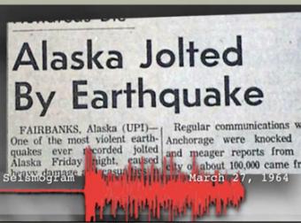
The 1964 Great Alaska Earthquake occurred on Good Friday, March 27th. Liquefaction in and around Anchorage tore the land apart. At magnitude 9.2, it was the second largest quake ever recorded by seismometers.
Go to Resource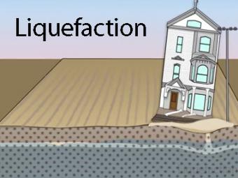
Liquefaction is a process by which water-saturated sediment temporarily loses strength and acts as a fluid. This effect can be caused by earthquake shaking.
Go to Resource
The 1964 Great Alaska Earthquake occurred on Good Friday, March 27th. Liquefaction in and around Anchorage tore the land apart. At magnitude 9.2, it was the second largest quake ever recorded by seismometers.
Go to Resource
Highly generalized animation reflects the arrivals of P, S, and surface waves to 3 closely spaced buildings. Exaggerated movement of the buildings reflects the relative motion recorded by the seismograms.
Go to Resource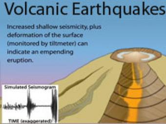
Earthquake activity beneath a volcano almost always increases before an eruption because magma and volcanic gas must first force their way up through shallow underground fractures and passageways. The continuous release of seismic energy is induced by the movement of magma.
Go to Resource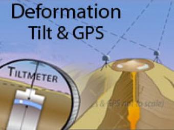
Volcano deformation can provide clues about what is happening deep below the surface. Two techniques used to monitor deformation include Tiltmeters and GPS.
Go to Resource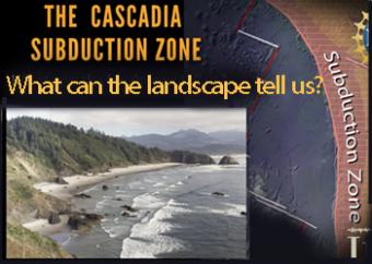
The Cascadia Subduction Zone of the Pacific Northwest is comprised of a collection of major geographic features, including the subducting plate, the subduction plate boundary, the Coast Range, the Puget-Willamette lowlands, and the Cascades Mountain Range.
Go to Resource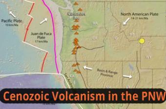
The Pacific Northwest boasts an active volcanic arc (Cascades), a nearby ocean ridge (between Pacific & Juan de Fuca Plates), the world’s youngest flood basalt province (Columbia River Basalt), a hot-spot chain of eastward-younging volcanoes (Yellowstone), Basin-Range extension, and more. This animation simplifies several complex tectonic interaction.
Go to Resource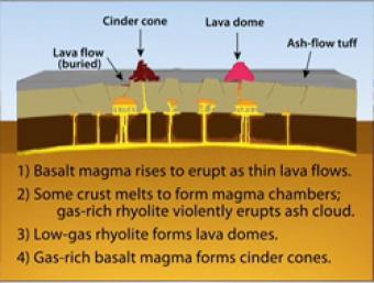
During Basin & Range extension, the plates pull apart, the mantle rises and melts due to lower pressures near the surface. The style of eruption depends on how long the magma sits in the crust and undergoes processes such as crystallization and melting and assimilation of wall rock.
Go to ResourceWe encourage the reuse and dissemination of the material on this site as long as attribution is retained. To this end the material on this site, unless otherwise noted, is offered under Creative Commons Attribution (CC BY 4.0) license
