59min Intermediate
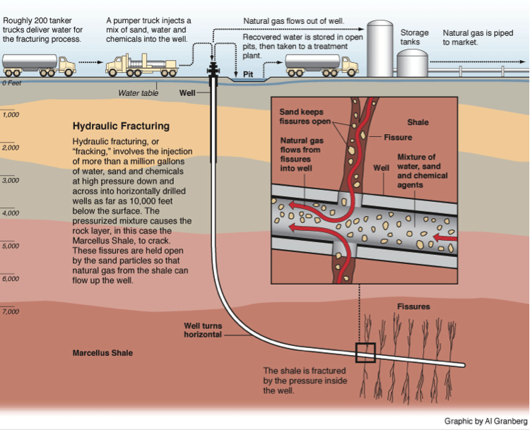
In this lab, students first investigate the processes involved in unconventional oil and gas resource production, i.e. hydraulic fracturing, including examining the regions in the US where hydrofracking is being conducted. They then compare those regions to the geology and recent seismicity on a US scale. The next step is for the students to conduct a detailed comparison of hydrofracking wells, waste water disposal wells, and seismicity on Oklahoma. They are asked to decide if they can draw correlations between fluid injection related to hydrofracking or from wastewater disposal and earthquake activity, and to consider ways that we might establish a better understanding of correlations between the two. Finally they are asked to make a claim, backed up by evidence, as to whether there is a causal link between any of the correlations.
The development of this resources was funded by the National Science Foundation via Award # 0942518
Students will be able to
1. Describe the processes involved in unconventional oil and gas production.
2. Collect and analyze seismicity data for a region of interest using the IRIS Earthquake Browser.
3. Use data to either support or refute potential correlations between hydrofracking and/or disposal wells and earthquakes in Oklahoma.
4. Describe how other processes, such as geothermal energy might similarly induce seismicity.
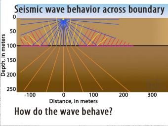
Seismic waves travel at different speeds through different materials. In this 2-layer model two wave fronts leave an impact at the same time but the lower layer is faster.
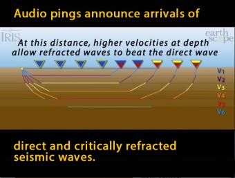
In this model of increasing velocity with depth, the critically refracted seismic rays speed up with depth as they pass 5 different velocity boundaries.
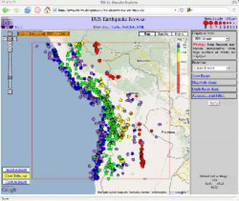
The IRIS Earthquake Browser (IEB) is an interactive tool for exploring millions of seismic event epicenters (normally earthquakes) on a map of the world. Selections of up to 5000 events can also be viewed in 3D and freely rotated with the 3D Viewer companion tool.
We encourage the reuse and dissemination of the material on this site as long as attribution is retained. To this end the material on this site, unless otherwise noted, is offered under Creative Commons Attribution (CC BY 4.0) license