
Novice
A program for the visualization of seismicity and volcanic activity in space and time
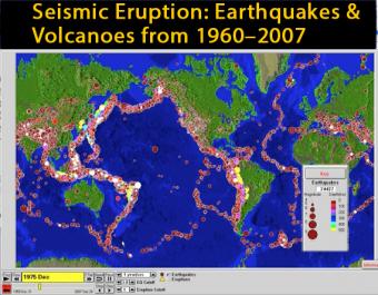
This animation of the PC program was created for those who are unable to use the program but want to see how Alan L. Jones' SeismicEruption program works. This particular version shows earthquakes for the period from 1960 until 2007. Both size of circles and the particular sounds depict the magnitude of each earthquake.
Alan L. Jones, of the State University of New York at Binghamton has created several computer-based visualizations: Seismic/Eruption, Seismic Waves, AmaSeis, and Eqlocate.
Seismic/Eruption is a program used to visualize seismicity and volcanic activity in space and time. The program displays earthquakes and volcanoes (data from the Smithsonian Institution Global Volcanism Program) and can show seismicity beneath the earth in three-dimensional and cross-sectional views. Programs can be downloaded from this page.
To download the SeismicEruption program go to the "Software" link above.
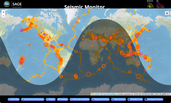
A beautiful map of the latest earthquakes in near-real time. The map also provides links to related resources, news, and connections to 3D maps.
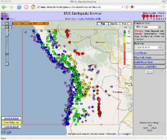
The IRIS Earthquake Browser (IEB) is an interactive tool for exploring millions of seismic event epicenters (normally earthquakes) on a map of the world. Selections of up to 5000 events can also be viewed in 3D and freely rotated with the 3D Viewer companion tool.
We encourage the reuse and dissemination of the material on this site as long as attribution is retained. To this end the material on this site, unless otherwise noted, is offered under Creative Commons Attribution (CC BY 4.0) license
