
9min 28s Novice Spanish
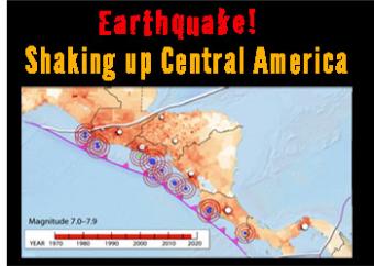
What are the major sources of earthquakes in Central America?
Central America is one of the most vulnerable and highest risk areas in the world for earthquakesis. It is squeezed by five tectonic boundaries, including a subduction zone boundary where the Cocos Plate dives beneath the Caribbean Plate. High risk is due to the complicated complicated tectonic landscape is populated by 50 million people, often in villages built before earthquakes were understood.
Whereas transform-fault and shallow-crustal-intraplate earthquakes have dominated the recent history of deadly and destructive earthquakes in Central America, we should never underestimate the potential destructive power of subduction zone earthquakes. Since 1970, there have been 13 major magnitude 7 earthquakes on or near the megathrust plate boundary, but no historic magnitude 8 or larger. The Sumatra 2004 and Japan 2011 magnitude 9 earthquakes and resulting tsunamis delivered the lesson that many centuries may pass between great subduction zone earthquakes. We do not know whether or when a great magnitude 8 or 9 subduction zone earthquake may occur on the Cocos – Caribbean plate boundary.
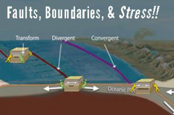
[updated 2021] Earth-science educators, do you ever get asked, "What is stress? Why do faults form in Earth’s crust? or How are faults related to plate boundaries?" This animation describes stress in Earth's outer layer and how it leads to both faults and tectonic plate boundaries.
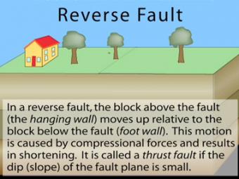
In a reverse fault, the block above the fault moves up relative to the block below the fault. This fault motion is caused by compressional forces and results in shortening. A reverse fault is called a thrust fault if the dip of the fault plane is small. Other names: thrust fault, reverse-slip fault or compressional fault]. Examples: Rocky Mountains, Himalayas.
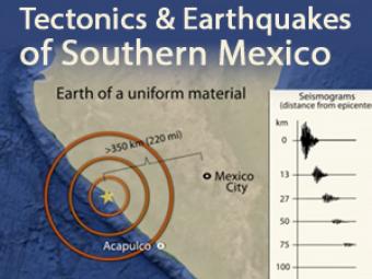
In 1985, a Great, magnitude 8.1 subduction zone earthquake occurred beneath the coast of Michoacan, Mexico causing over 9,000 fatalities over 350 km away. What caused it and how has Mexico instituted their Earthquake Early Warning system? This animation describes the mechanics.
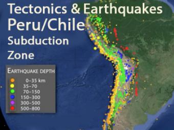
This animation explores three major mechanisms for earthquakes in South America due to the interaction of the Nazca and South American plates.
We encourage the reuse and dissemination of the material on this site as long as attribution is retained. To this end the material on this site, unless otherwise noted, is offered under Creative Commons Attribution (CC BY 4.0) license
