1h Advanced
This lesson covers seismic methods and their use in the petroleum industry. The lecture presents both land and marine seismic acquisition and processing techniques, and their use in interpretation of local geology. The maps developed from seismic acquisition and interpretation can help to identify structural features and the location of hydrocarbons.
The lesson can begin with a review of the previous lesson's exercise (Introduction to Well Logs), which contains three (3) slides and should take seven (7) minutes to cover. The lecture material has fifteen (15) slides, and will take approximately 35 minutes to present.
This lesson material also contains an exercise in three (3) parts. Part A contains four (4) slides, and takes about 5 minutes to introduce. Part B contains four (4) slides, and takes about three (3) minutes to introduce. Lastly, Part C contains four (4) slides, and will take approximately three (3) minutes to explain.
At the end of the lecture and exercises, the student should be able to:
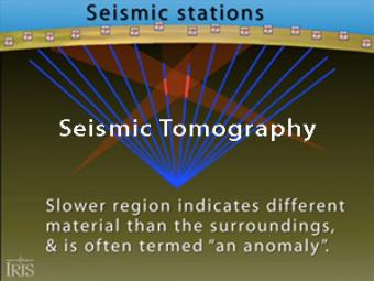
Seismic tomography is an imaging technique that uses seismic waves generated by earthquakes and explosions to create computer-generated, three-dimensional images of Earth's interior. CAT scans are often used as an analogy. Here we simplify things and make an Earth of uniform density with a slow zone that we image as a magma chamber.
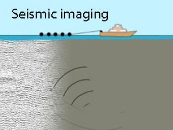
Man-made sound waves produced by airguns travel through the earth, reflect off different rock layers, then are recorded by geophones being towed behind the boat.
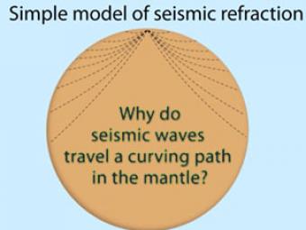
Seismic waves travel a curving path through the earth due to changes in composition, pressure, and temperature within the layers of the Earth.
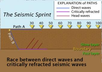
In this model of increasing velocity with depth, the critically refracted seismic rays speed up with depth as they pass 5 different velocity boundaries.
This course, based on teaching material from Dr. Fred Schroeder (formerly of Exxon/ExxonMobil), reflects on the geology and geophysics basics for the petroleum industry. General geology and basic geophysics are not required, but helpful with the material.
We encourage the reuse and dissemination of the material on this site as long as attribution is retained. To this end the material on this site, unless otherwise noted, is offered under Creative Commons Attribution (CC BY 4.0) license