
Novice
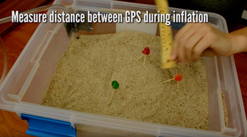
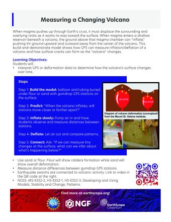
This hands-on demonstration illustrates how GPS can be used to measure the inflation and deflation of a volcano. It also shows how the rocks at the summit of a volcano weaken and crack to form a crater or caldera as the volcano inflates and deflates. The difference between a volcanic caldera and a volcanic crater is that calderas are really wide, often more than a mile in diameter. The Yellowstone caldera is approximately 50 miles (80 km) long and 40 miles (65 km) wide!
Students will measure changes at the surface of the physical model of a volcano to understand how GPS stations are used to measure volcanic deformation.
We encourage the reuse and dissemination of the material on this site as long as attribution is retained. To this end the material on this site, unless otherwise noted, is offered under Creative Commons Attribution (CC BY 4.0) license
