Geophysical Events
We provide data and educational content for significant geophysical events like earthquake and volcanic eruptions. Visit the IRIS archive for older Teachable Moments or the UNAVCO archive for older Event Responses. To receive notifications of educational content for notable earthquakes, see the Mailing Lists page.

M 4.8 New Jersey
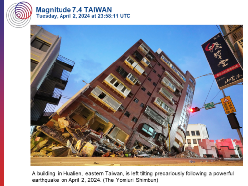
M 7.4 Taiwan
A 7.4-magnitude earthquake, followed by several strong aftershocks, struck off the east coast of Taiwan on Wednesday morning 18km (11.2 miles) SSW of Haulien City, Taiwan at a depth of 34.8 km (21.6 miles).
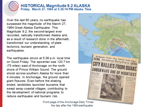
Historical M 9.2 Alaska (1964)
A magnitude 9.2 earthquake struck Alaska at 5:36 p.m. local time on Good Friday, 1964. The epicenter was 120.7 km (75 miles) east of Anchorage on the north shore of Prince William Sound.
M 7.0 China
At 18:09:04 (UTC) on January 22, 2024, a magnitude 7.0 earthquake occurred on the border of China and Kyrgyzstan.
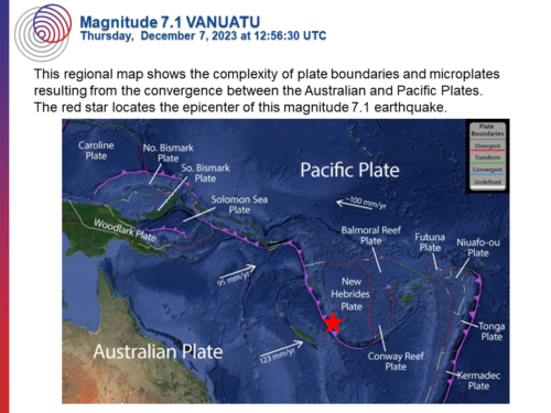
M 7.1 Vanuatu
A magnitude 7.1 earthquake struck just after 4:56 AM local time about 123 km (80 mi) south of Isangel, Vanuatu (population 1,200), the provincial administrative capital of Tafea Province which is the southernmost of the seven provinces of Vanuatu.
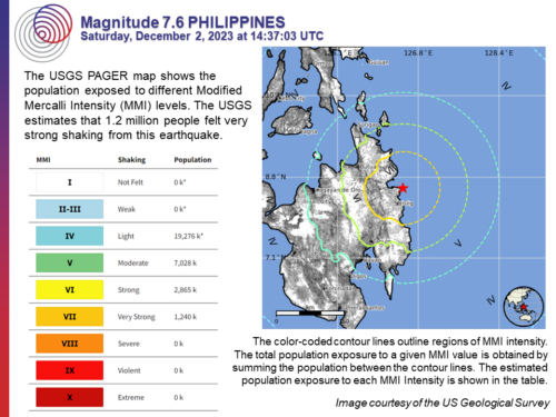
M 7.6 Philippines
A magnitude 7.6 earthquake occurred Saturday off the coast of the southern Philippines island of Mindanao. The earthquake occurred at 10:37 p.m. at a depth of 32 kilometers (20 miles).
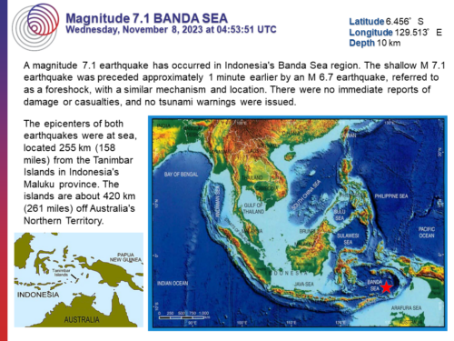
M 7.1 Banda Sea
A magnitude 7.1 earthquake has occurred 255 km (158 miles) from the Tanimbar Islands in Indonesia’s Maluku province.
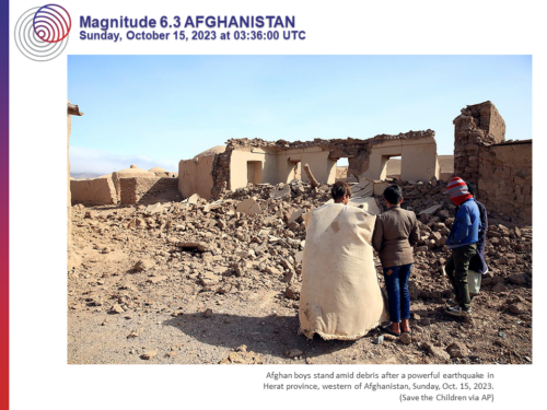
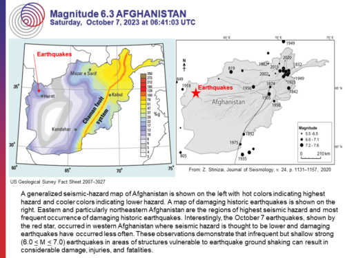
M 6.3 Afghanistan
A fourth magnitude 6.3 earthquake has struck western Afghanistan. This is the latest in a sequence of 27 earthquakes that have occurred since October 7, 2023.
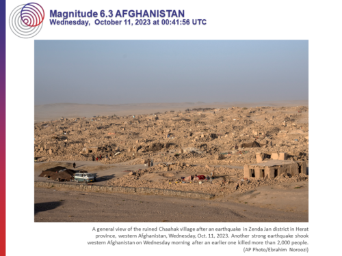
M 6.3 Afghanistan
Another magnitude 6.3 earthquake has struck western Afghanistan, the 3rd M 6.3 earthquake in a sequence of 19 earthquakes that have occurred since October 7, 2023.