


Can I see all the teachable moments on a map? On Google Earth?
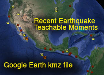
The Incorporated Research Institutions for Seismology has plotted Recent Earthquake Teachable Moment (RETM) presentations into Google Earth, available here as a .kml file. Touch the red-seismogram icons to see a brief description of each earthquake with a link to IRIS’s individual resource pages. These teachable moments are rapid-response presentations for educators following worldwide earthquakes of greater than magnitude 7.0, and newsworthy smaller earthquakes. The kml file updates whenever a new RETM is released.
The yellow (English) and orange (Spanish) projector icons link to IRIS' regional tectonic and earthquake animations. These animations look at the tectonics that affect regional earthquake history, as well as the mechanics of earthquakes in the region.
STEPS IF YOU HAVE GOOGLE EARTH:
1) Click Download button
2) Find the downloaded kml and kmz files on your computer.
3) Double-clicking each file will place their folders in Google Earth.
4) Toggle the folder in Google Earth to see the list of links
IF YOU DON'T HAVE GOOGLE EARTH, "google" download google earth to get a free copy.
Two folders available in this download include:
We encourage the reuse and dissemination of the material on this site as long as attribution is retained. To this end the material on this site, unless otherwise noted, is offered under Creative Commons Attribution (CC BY 4.0) license


