


What is causing the PNW coastal areas to move?
In this lab, students investigate mysterious ground motions along the Pacific Northwest Coast. The investigation begins as students familiarize themselves with the tectonic setting of the Pacific Northwest coastal region . Next, students explore and explain the movement of the Cape Mendocino, CA region that occurred on April 25th, 1992 using data (vector) from high-precision Global Positioning System (GPS) stations and earthquake location data. This case is contrasted with movement recorded by GPS (time-series) in British Columbia from 2004 to 2011. Finally, students investigate a model to explain the GPS time series data for the British Columbia region.
The development of this resources was funded by the National Science Foundation via Award # 0942518
Students will be able to…
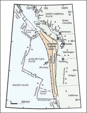
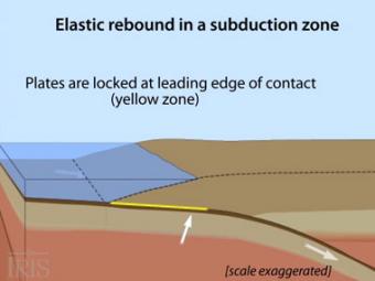
The subduction zone iswhere two tectonic (lithospheric) plates come together, one subducting (diving) beneath the other. The plates are locked together and periodically overcome the friction causing the leading edge of the overlying plate to surge back, lifting a wall of water producting a tsunami.
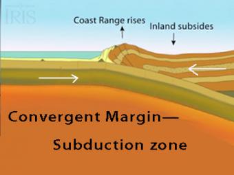
Oblique view of a highly generalized animation of a subduction zone where an oceanic plate is subducting beneath a continental plate. (See sketch below for parts.) This scenario can happen repeatedly on a 100-500 year cycle. The process which produces a mega-thrust earthquake would generate a tsunami, not depicted here.
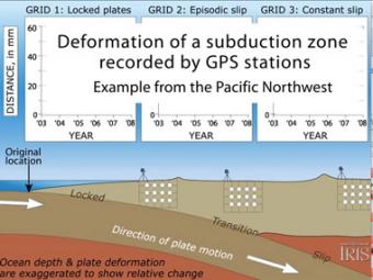
Subduction zones show that there are 3 distinct areas of movement in the overlying plate:
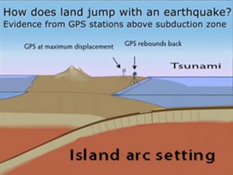
GPS records the movement of the leading edge of the overlying continental plate in a subduction zone. The plates are locked and the overlying plate is forced back. When friction is overcome and strain is released, the GPS receiver will snap back toward its original position.
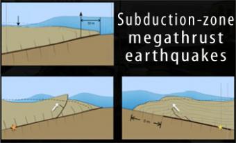
Subduction-zone megathrust earthquakes, the most powerful earthquakes in the world, can produce tsunamis through a variety of structures that are missed by simple models including: fault boundary rupture, deformation of overlying plate, splay faults and landslides. From a hazards viewpoint, it is critical to remember that tsunamis are multiple waves that often arrive on shore for many hours after the initial wave.
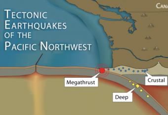
It is common knowledge that the Pacific Northwest can expect a subduction-zone megathrust earthquake in the future. But did you know that there are other types of damaging earthquakes. This animation uses analogies and cartoon block diagrams to teach about the three types of earthquakes.
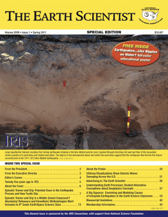
In the Spring of 2011, the IRIS Consortium's EPO program guest edited a special seismology themed issue of The Earth Scientist. The Earth Scientist is the journal of the National Earth Science Teachers Association.
We encourage the reuse and dissemination of the material on this site as long as attribution is retained. To this end the material on this site, unless otherwise noted, is offered under Creative Commons Attribution (CC BY 4.0) license


