


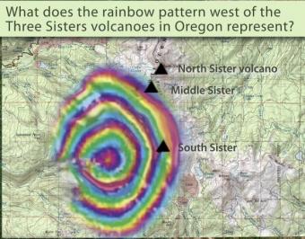
Between 1997-2001 the ground around the Three Sisters Volcanoes in Oregon bulged indicating magma was rising. This bulge was detected using InSAR.
InSAR stands for Interferometric Synthetic Aperture Radar. Satellites record images of the Earth's surface, and these images can be combined to show subtle movements of the ground surface, called deformation. InSAR is a proven technique for mapping ground deformation using radar images from Earth-orbiting satellites. InSAR greatly extends the ability of scientists to monitor volcanoes because, unlike other techniques that rely on measurements at a few points, InSAR produces a spatially complete map of ground deformation with centimeter-scale accuracy without subjecting field crews to hazardous conditions on the ground.
[Description from USGS's https://volcanoes.usgs.gov/activity/methods/insar/
for more on the Three Sisters "bulge": http://volcanoes.usgs.gov/volcanoes/three_sisters/three_sisters_geo_hist_129.html]
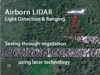
Airborne LIDAR is an optical remote sensing tool that uses laser pulses to measure the precise distance to the ground. The airplane-mounted laser range-finding system, transmits and receives data, which are precisely located using a highly sensitive GPS receiver. Computer-generated images reveal hidden faults not seen through the vegetation.
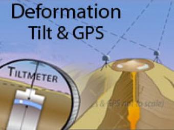
Volcano deformation can provide clues about what is happening deep below the surface. Two techniques used to monitor deformation include Tiltmeters and GPS.
Volcano deformation can provide clues about what is happening deep below the surface. Two techniques used to monitor deformation include Tiltmeters and GPS.
We encourage the reuse and dissemination of the material on this site as long as attribution is retained. To this end the material on this site, unless otherwise noted, is offered under Creative Commons Attribution (CC BY 4.0) license


