


How does deformation change the land above a subduction zone?
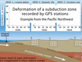
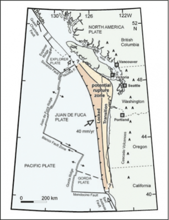
Recent data from the Pacific Northwest and other subduction zones show that there are 3 distinct areas of movement above a subduction zone: 1) constant movement above the locked leading edge, 2) see-saw pattern of back-&-forth movement above a zone that alternately locks then slips in a process called episodic tremor and slip , and 3) no movement far inland above the deeper part of the diving oceanic plate.
CLOSED CAPTIONING: A .srt file is included with the downloiad. Use appropriate media player to utilize captioning.
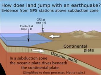
GPS can record the movement of the leading edge of the overlying continental plate in a subduction zone. The plates are locked and the overlying plate is forced back. When friction is overcome and strain is released, the GPS receiver will snap back toward its original position.
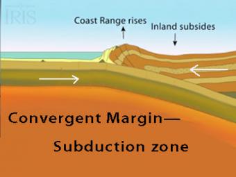
The subduction zone iswhere two tectonic (lithospheric) plates come together, one subducting (diving) beneath the other. The plates are locked together and periodically overcome the friction causing the leading edge of the overlying plate to surge back, lifting a wall of water producting a tsunami.
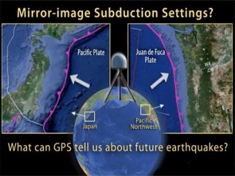
This UNAVCO animation compares Japan's subduction zone at the location of the 2011 earthquake with a mirror-image subduction zone in the Pacific Northwest. There are many similarities.
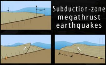
Subduction-zone megathrust earthquakes, the most powerful earthquakes in the world, can produce tsunamis through a variety of structures that are missed by simple models including: fault boundary rupture, deformation of overlying plate, splay faults and landslides. From a hazards viewpoint, it is critical to remember that tsunamis are multiple waves that often arrive on shore for many hours after the initial wave.
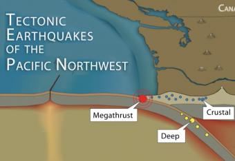
It is common knowledge that the Pacific Northwest can expect a subduction-zone megathrust earthquake in the future. But did you know that there are other types of damaging earthquakes. This animation uses analogies and cartoon block diagrams to teach about the three types of earthquakes.
Students work in small groups to analyze and interpret Global Positioning System (GPS) and seismic data related to “mysterious ground motions” first along the northern California coastline, and then in British Columbia. This activity emphasizes the analysis and synthesis of multiple types of data and introduces a mode of fault behavior known as Episodic Tremor and Slip (ETS)
We encourage the reuse and dissemination of the material on this site as long as attribution is retained. To this end the material on this site, unless otherwise noted, is offered under Creative Commons Attribution (CC BY 4.0) license


