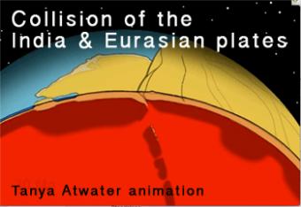
This animation shows a cut-globe view of the continental collision between India and Eurasia from 60 million years ago to present. Many details are drawn reflecting ideas current in about 2006, and are subject to change as research continues.
Created by Tanya Atwater (U.C. Santa Barbara) and used with permission. Downloaded from: http://emvc.geol.ucsb.edu/1_DownloadPage/Download_Page.html#GlobalTectonics
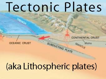
The subduction zone iswhere two tectonic (lithospheric) plates come together, one subducting (diving) beneath the other. The plates are locked together and periodically overcome the friction causing the leading edge of the overlying plate to surge back, lifting a wall of water producting a tsunami.
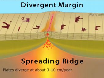
New oceanic crust is created at this boundary when basalt magma, formed in the mantle, rises into fractures in the crust and solidifies. Spreading ridges are high elevation because the young oceanic plate at the ridge crest is hot and less dense than the older, colder and more dense plate on the flanks of the ridge.
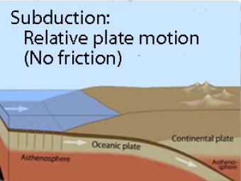
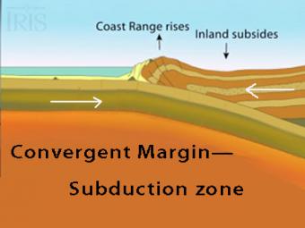
Oblique view of a highly generalized animation of a subduction zone where an oceanic plate is sliding beneath a continental plate with no friction just to show the relative motion between the plates..
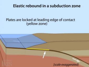
Oblique view of a highly generalized animation of a subduction zone where an oceanic plate is subducting beneath a continental plate. (See sketch below for parts.) This scenario can happen repeatedly on a 100-500 year cycle. The process which produces a mega-thrust earthquake would generate a tsunami, not depicted here.
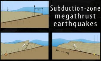
Subduction-zone megathrust earthquakes, the most powerful earthquakes in the world, can produce tsunamis through a variety of structures that are missed by simple models including: fault boundary rupture, deformation of overlying plate, splay faults and landslides. From a hazards viewpoint, it is critical to remember that tsunamis are multiple waves that often arrive on shore for many hours after the initial wave.
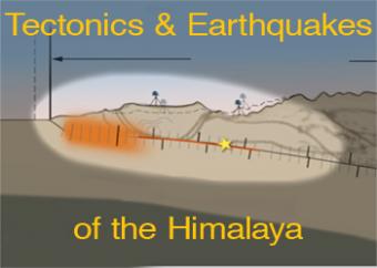
Regional compression produces broadly distributed earthquakes north of the Himalayan plate boundary. However, the historical earthquake record indicates that the largest occur on the shallow portion of the megathrust boundary. This animation discusses regional processes and focusses on the 2015 Nepal earthquake. Watch video footage of Kathmandu with a graph of GPS motion at 2min 55sec provided by UNAVCO.
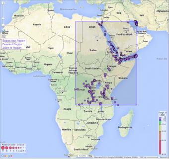
In this exercise, students will learn about the various types of plate boundaries, investigate well-known examples of some of these boundaries, and then apply what they have learned to East Africa to determine the most likely cause of seismicity in this area of the world.
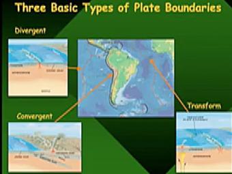
Video lecture covers three basic types of tectonic plate boundaries.
We encourage the reuse and dissemination of the material on this site as long as attribution is retained. To this end the material on this site, unless otherwise noted, is offered under Creative Commons Attribution (CC BY 4.0) license